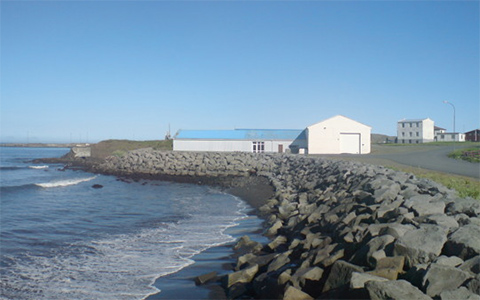
The area around Salthús Guesthouse
The Arctic Coast Way
![]()
For those exploring North Iceland, or driving the Ring Road clockwise, starting their tour from Reykjavik, the Salthus Guesthouse is a natural location for the first night’s stay after traveling through West and Northwest Iceland. The Salthus Guesthouse is also the perfect place for your last night if you have driven the Ring Road anti-clockwise, where you started in South-Iceland and continued through East and North Iceland.
The dedicated website Arcticcoastway.is describes the route in short as “where volcanic land meets the icy ocean, nature´s force has carved a coastline of wild and pure beauty. The route includes six peninsulas reaching far out in the ocean, taking you from black sandy beaches to spectacular cliffs, along glacial river deltas and fjords to high mountains. Going one step further into remoteness, five beautiful islands offer unforgettable experiences and you might even want to straddle the Arctic Circle. Each of the little towns along the way tells a unique story about life on the edge of the Arctic.”
The Arctic Coast Way has been featured in several articles on the Internet.
The Arctic Coast Way was chosen by Lonely Planet to be on the Best in Europe in 2019,list or “the essential European destinations to visit this year”.
National Geographic Travel UK ran a feature about the route.
Condé Nast Traveler describes a five-day trip along the route in its feature “Skip the Golden Circle—Take Iceland’s New Arctic Coast Way Instead”.
A comprehensive description of the coast way is on the dedicated website Arcticcoastway.is.
The coast way is described comprehensively on the website Northiceland.is.
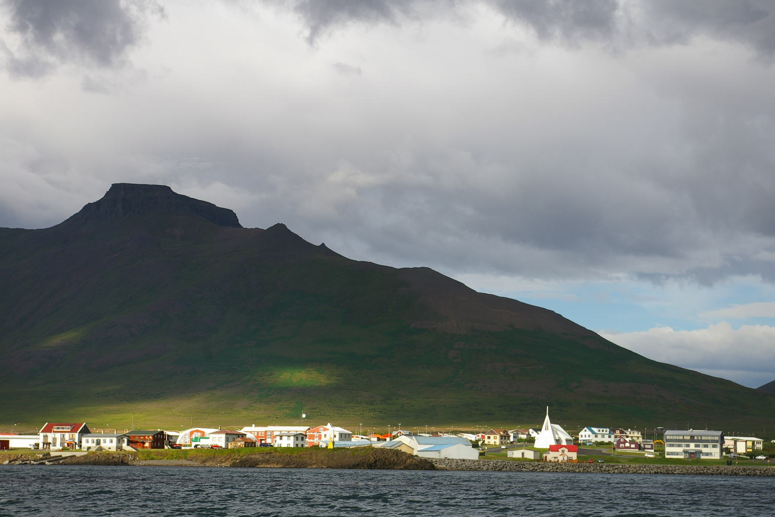
The town of Skagaströnd
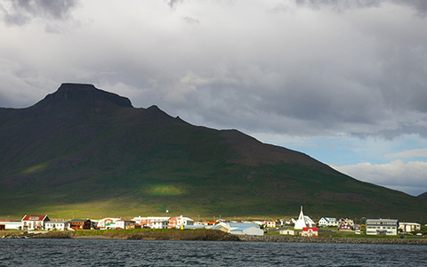
Skagaströnd with Spákonufell mountain in the background.
The laid back town of Skagaströnd sits on the shore, on the western part of the Skagi peninsula in North-West Iceland. It is located around 20 km north of the town of Blonduos. To reach Skagastrond, you drive north road #74, from the ring road #1. This town of 500 inhabitants is a center of fisheries and marine research, and also an international center for creative arts. There is a grocery store, a sports center and a swimming pool with a hot- tub in town, and a 9 hole golf course nearby. There is a newly opened Harbour restaurant in town, it is in walking distance just down on the docks. For opening hours and menu please consult their Facebook page www.facebook.com/harbour545. The cultural centers in town are the Spákonuhof – Museum of Prophecies, Nes Artist Residency and the Hólanes church.
From the late 15th century Skagastrond was the main trading center for the East-Hunavatns county, and the place where Danish merchants traded with the locals and ran their shops. It has been a notable center of entrepreunerial activity in the 20th and 21st century, with fishing industries and a fish market and now also Biopol, the center for research and innovation in the field of marine biotechnology.
Tindastóll Ski Area
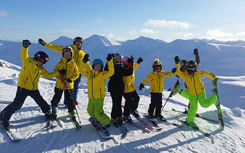
Four ski lifts and a variety of ski slopes await guests at Tindastóll.
The Tindastóll skiing and snowboarding area is located on the eastern side of the Skaginn peninsula, about a 30 minute drive from Skagaströnd. Salthús Guesthouse is well located for those who are interested in a skiing vacation at this skiing area. In the winter of 2018-19, guests will enjoy a new 1000 meter ski lift, which will continue from the top of the current 1150 meter ski lift. These two ski lifts take the visitor up to a combined height of 900 meters above sea level, and offer slopes that are a perfect fit for skiers of a varied level of expertise. There are plans to develop the area further and install another 1100 meter long ski lift, which will reach the height of 800 meters above sea level. A new ski lift suitable for children and beginners is also planned. To reach the Tindastóll ski area, you drive around 15 km south from Skagastrond, and then turn east on Þverárfjallsvegur (road # 744), and drive about 16 km, to the junction for the Tindastóll mountain and ski area.
The skiing area usually opens in November/December and stays open, based on weather and snow conditions, until April and even sometimes May. There is a ski rental shop with all neccessary equipment, where the Ski lift passes are also available for a modest fee. Click here to see the website of the Tindastóll skiing area, (in Icelandic).
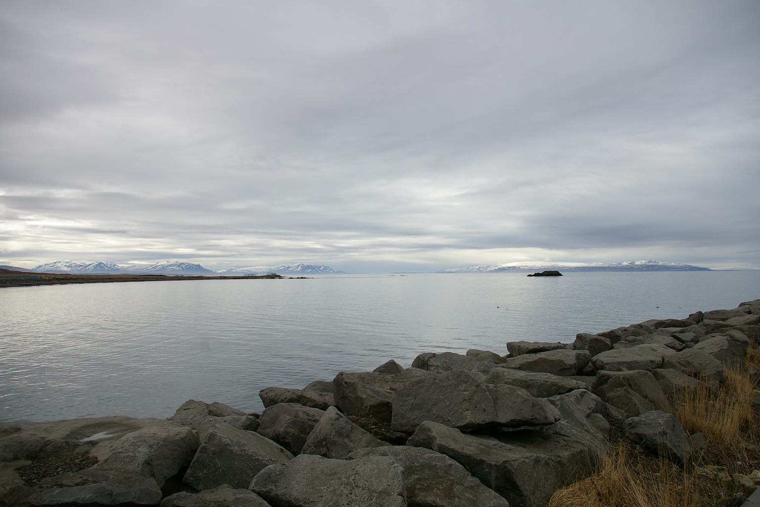
Cape Spákonufellshöfði
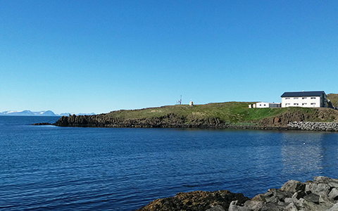
Cape Spákonufellshöfði and the Salthús Guesthouse to the right.
The cape of Spákonufellshöfði is a protected country park and a popular outdoors area in the northern part of the town. It is named after Thordis the prophetess, (see the text about the Spakonufell mountain). The cape offers a great view around the surrounding area. You can see the mountain range of Skaginn, and to the west, beyond the Húnaflói bay, are the Strandir area of the Westfjords. There are a few short hiking routes on the cape, that offer a lot of interesting things to see. A good number of signs have been erected, with information about bird life and plants on the cape.
Cape Spákonufellshöfði is probably an old volcanic plug in a volcano that erupted around seven million years ago. At the southern end of the cape is Hólsnef and Höfðatá. The cove north of that is named Vækilvik, and Vælugil (Wailing Canyon) is a small ravine on its south side. The name comes from the fact that a wailing sound is heard in the ravine in certain wind directions. In the middle between Hólsnef and Vækilvík is a cliff that is named Tröllamey (Troll Maiden). The saga goes that a troll maiden sat there and waited for her husband to return from a fishing trip, and the sun came up leading her to turn into stone. North of the cove is Reiðingsflöt (Tackle Flat), where farmers loaded their horses with wares after trading with merchants. A majestic rock further north is named Arnarstapi (Eagle Mesa), and east from it is Leynidalur (Secret Valley) or Fagridalur (Fair Valley). There is a periscope at the highest point of the cape, with information about landmarks all around.
Click here to download a brochure in PDF format about the cape. In the image gallery below, you can also see a map of the cape.
Birdwatching
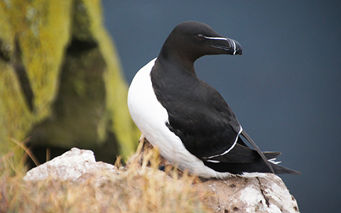
The Razorbill is one of the seabirds that can be seen in the area.
Birding in Skagaströnd in Northwesthern Iceland has increasingly become more popular with travellers and locals alike, with the Spákonufellshöfði cape, a thematic park right by the Salthús Guesthouse, as the main area of interest. On the cape you can spot a mixture of sea-birds and moorland birds during the summer time and ravens, ducks and other sea birds in the winter. Birds such as eider, raven, sea-gulls and puffins can be seen in the area as well as merlin, arctic tern, sea pie, golden plower, curlew, snipe and thrush as well as foreign stowaways that arrive here with fishing ships.
The cape has been surveyed by an architectural firm in order to put forth ideas for a bird watching shelter. Hopefully this idea will be realized in the near future to make birding more accessible for bird watchers and photographers, and also those looking to view the Northern lights.
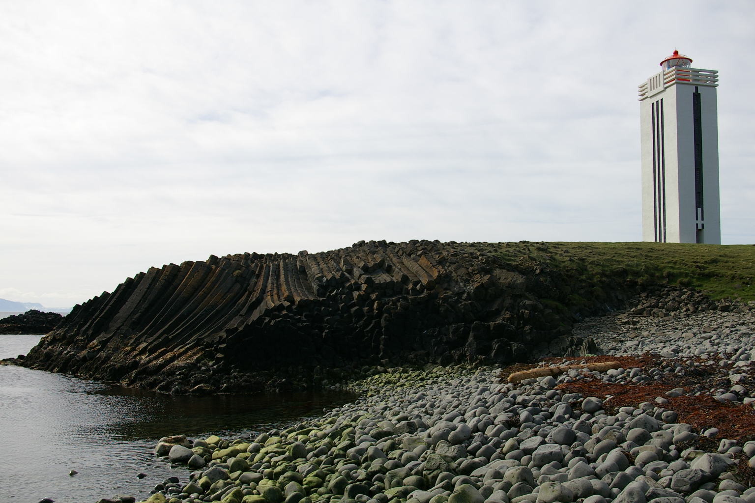
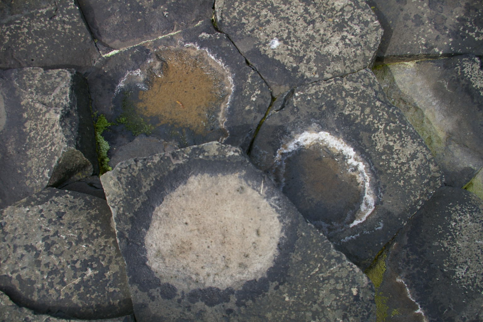
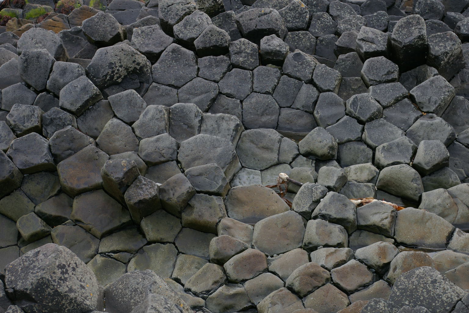
Kálfshamarsvík
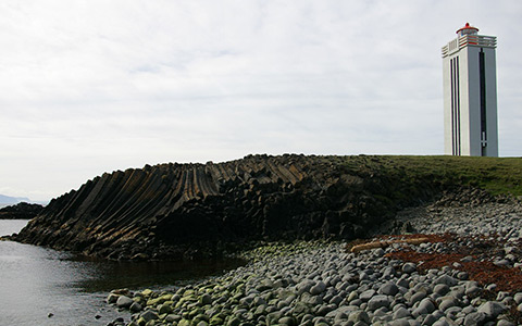
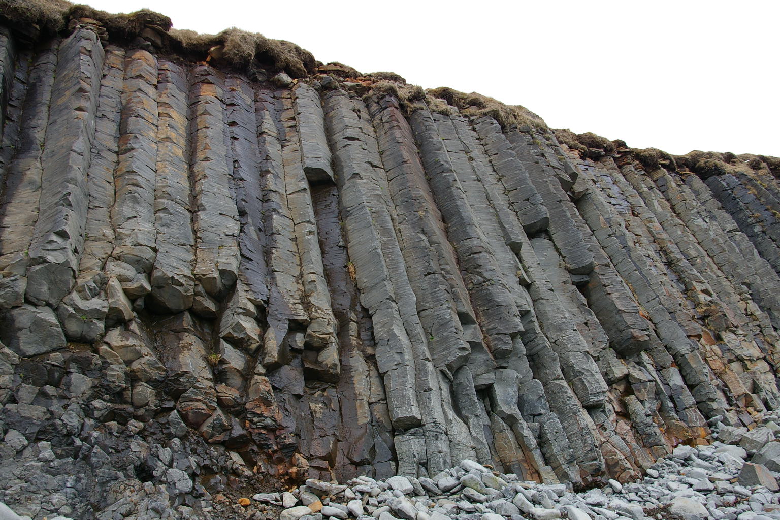
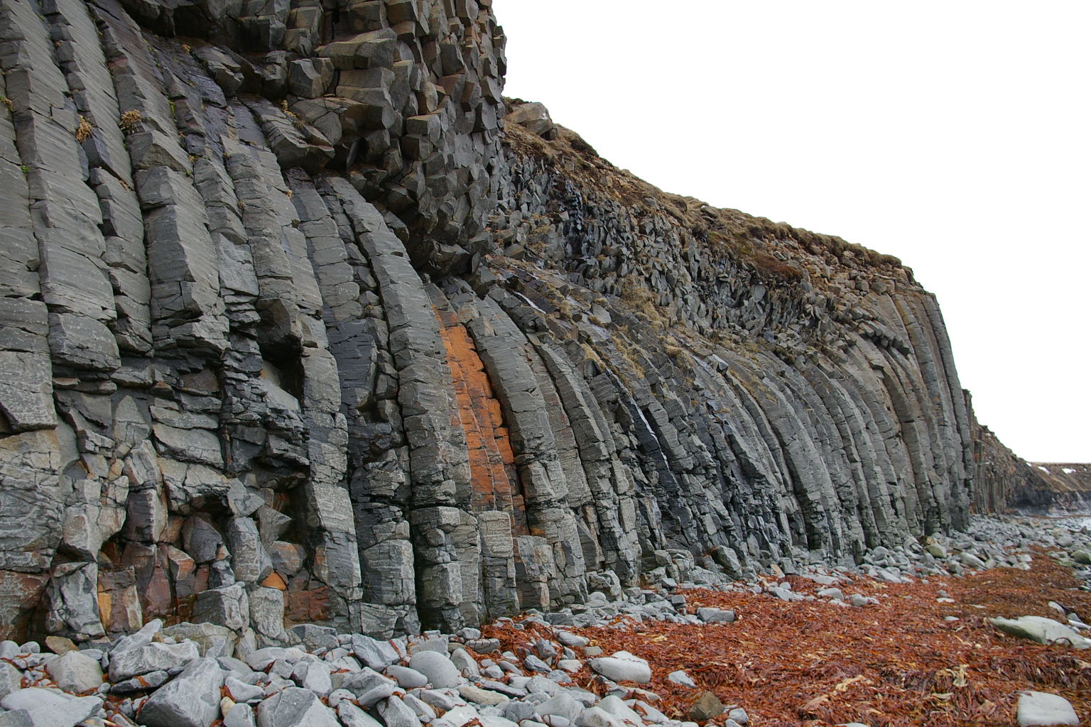
The columnar basalt cliffs and lighthouse at Kálfshamarsvík.
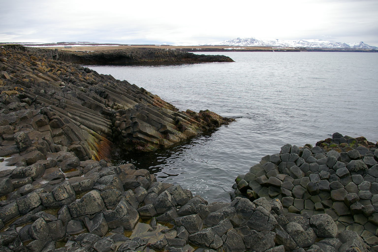
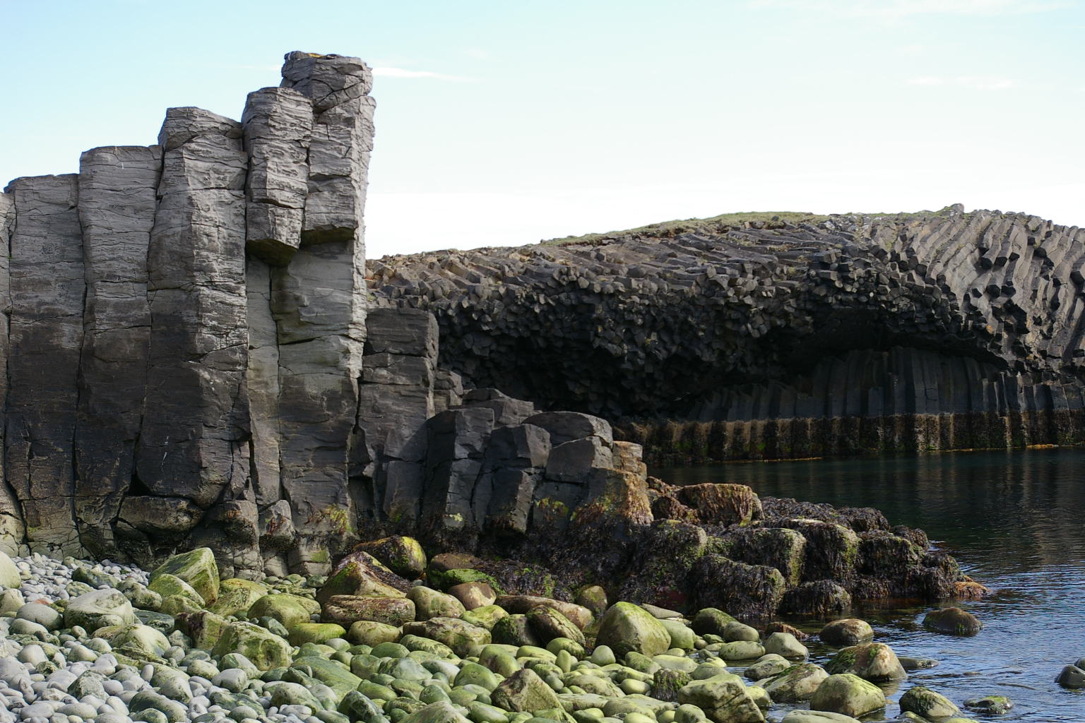
The Kálfshamarsvík cove is the most notable attraction on Skaginn peninsula. It is located around 20 km north of Skagaströnd. The fantastic art-déco styled lighthouse, built in 1939 is situated on the Kálfshamarsnes promontory, is. On Kálfshamarsnes there are many versions of beautiful hexagonal columnar basalt cliffs, that were formed two million years ago. They rise up from the seashore of oval, sea-worn rocks, at the Kálfshamar cliffs.
At Kálfshamarsvík, you will also find the ruins of the first urban settlement in the area, where a about 100 people, fishermen and their families, lived in small houses in the 19th century and first half of the 20th century. Salted cod was processed in Kálfshamarsvik, and sold to the Mediterranean. Fishing activities declined after 1930, and the settlement was abandoned in 1940. The ruins of the settlement are marked with information signs. Kálfshamarsvík has many positive reviews on Tripadvisor.
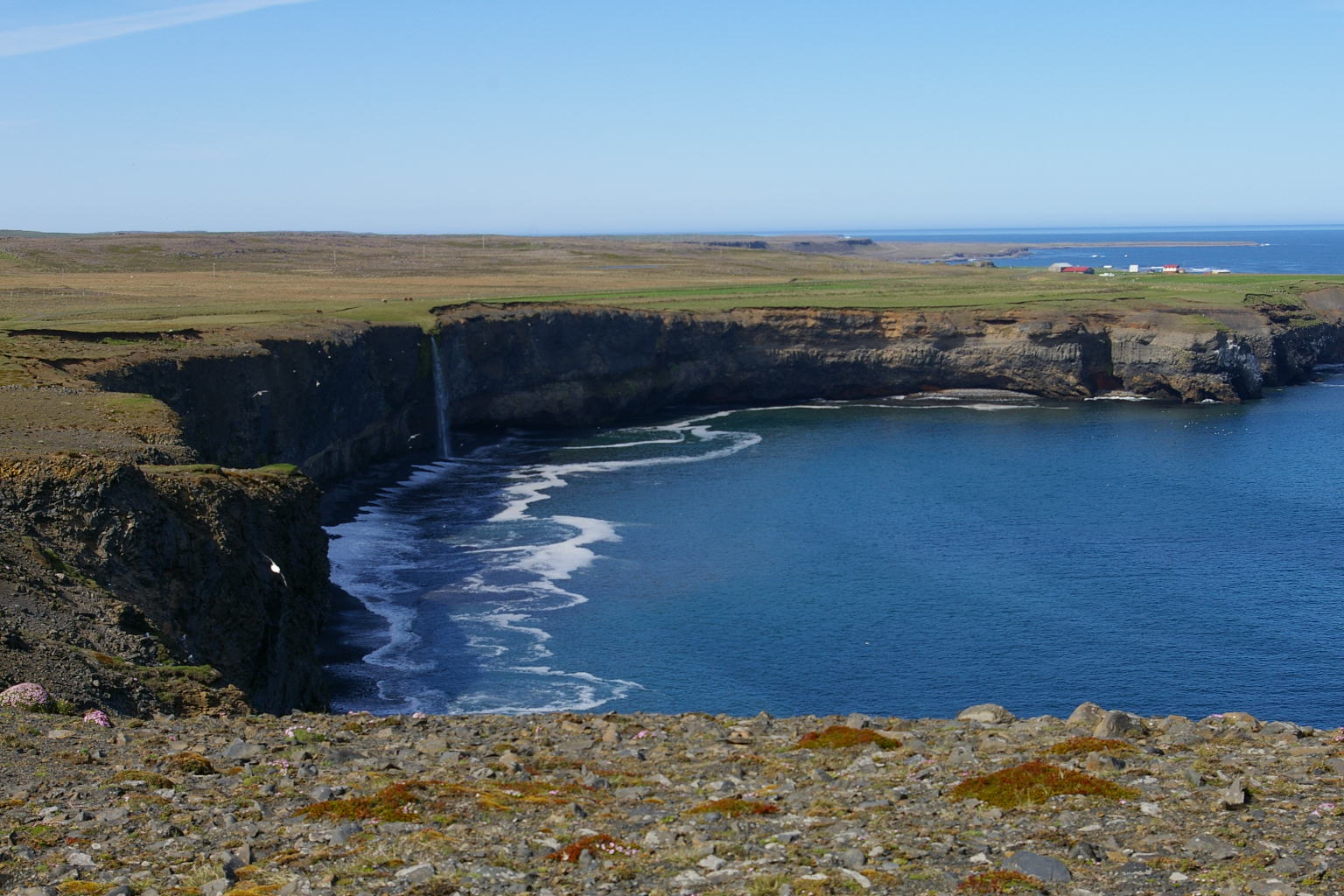
Skaginn

Keta cliffs on the east side of Skaginn.
The Skagi peninsula is in the western region of North-Iceland. The southern part of the peninsula is mountainous with farmsteads in the narrow lowland. The northern part of the peninsula offers vast open spaces, characterized by a rather flat and barren landscape, with the nature greatly affected by the proximity of the cold Arctic Ocean. A road lies around the peninsula by the coast, where the main visitor attractions are located. Along with the Kálfshamarsvík cove, Skaginn also offers Króksbjarg cliffs with birds nests and the Fossárfoss waterfall, with Spánskanöf south of Skagaströnd, and on the east side is the Keta cliffs, with more than 120 meters high (370 feet) cliffs, where trolls lived according to folklore. The desolate Skaginn heath offers lakes with trout fishing with guided tours from Blönduós.. On Skaginn peninsula there are three main towns: Skagaströnd and Blönduóss on the western side, and Sauðárkrókur on the eastern side.
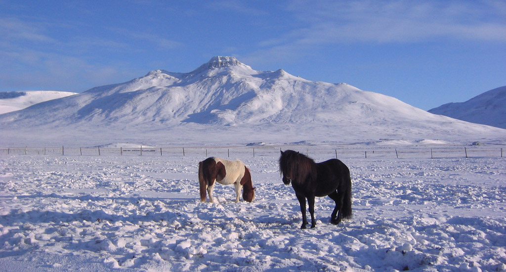
Spákonuhof and Spákonufell mountain
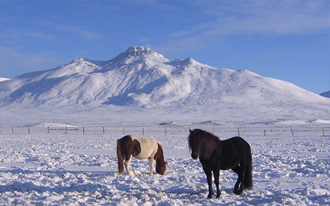
Spákonufell mountain in winter,with two Icelandic horses.
Spákonuhof is a museum and cultural center honoring the memory of Þórdís (Thordis) the prophetess, (number 11 on the map below). Thordis the prophetess (spákona), lived on a farm in its foothills of the mountain, in the 10th century near the end of the pagan times. She was the first Icelander who was named as a settler of Skagastrond, in the medieval Icelandic Sagas. The story goes that she was the first settler in Skagaströnd. Every day, she walked upon the Spákonufell mountain and combed her hair with a golden comb. She hid all her gold in the mountain, and put a spell on it so that no one could find the gold except a woman who was not baptised, and had never heard the Christian God‘s words. The gold has never been found. Click on the links to see an information page about Spákonuhof, and here is the page of Spákonuhofs on Facebook.
The Spákonufell mountain towers over Skagaströnd. The mountain is named after Thordis. It has one of the most distinct facade of the mountains in the area, with its flat table top. Spákonufell is a nice mountain to hike with its 646 meters (2,119 feet) and the view is spectacular from the top.
Nes Artist Residency
The Nes Artist Residency studio building at Skagaströnd.
The Internationally acclaimed Nes Artist Residency is located in Skagastrond. This center for art and creativity was established in 2008 and is closely affiliated with the Salthús guesthouse, where some of the artists stay during their residency. Nes has received about one thousand artists from all around the world, who have enriched the cultural life of Skagastrond through workshops, exhibitions, performances and art festivals.
NES is a multidisciplinary residency, which accepts applicants from all creative fields and career stages. Additionally, Nes offers a writer-in-residence program in collaboration with the local branch of the University of Iceland.Nes is also able to coordinate access to additional facilities for dancers, composers, musicians, filmmakers and researchers, or anyone who might require additional space to work. NES accepts applicants on the basis of self-definition, and does not seek to define “who is an artist” when evaluating applications. Click here for the website of Nes Artist Residency.
Activities and services in Skagaströnd
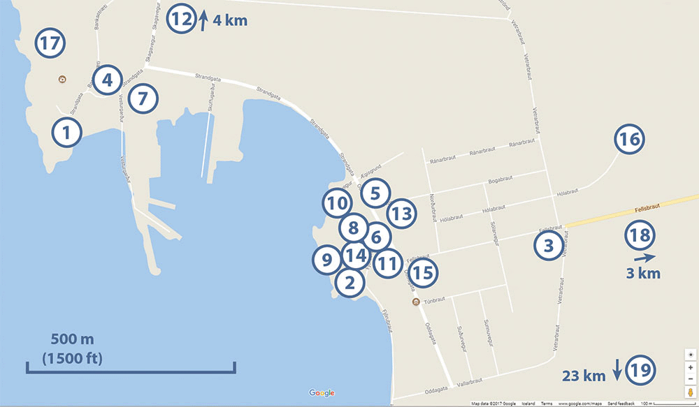
Activities and services, and notable places in Skagaströnd, refer to the list of numbers below.
1. Salthús Guesthouse.
2. Nes Artist Residency, artists studios.
3. Fellsborg Community Center.
4. Communal swimming pool, with showers and hot tub, (open: June-August Mon-Fri 10-20, Sat-Sun 13-17; September-May Mon-Fri 17-20, Sat-Sun 13-17).
5. Kjörbúðin grocery store (open: Mondays to Fridays 9-18:00, Saturdays 10-18:00, Sundays 12-18:00).
6. Skagaströnd bus stop, at Olís gas station, including Road 66 burgers and pizza, drinks and snacks, (open: Mondays to Thursdays 08-21:00, Fridays 08-22:00, Saturdays 10-22:00, Sundays 10-21:00).
7. Harbour Restaurant, (telephone +354-555-0545, Facebook page www.facebook.com/harbour545).
8. Hólanes Restaurant, (telephone +354-784-8989, Facebook page www.facebook.com/Holanes.Restaurant.Bar).
9. (No opreations here currently).
10. Post office and Landsbankinn bank.
11. Skagaströnd Sports Center, with well equipped gym, steam bath, sports hall, climbing wall, and badminton course.
12. Skagaströnd Golf Club, at Háagerdi golf course, 4 km (2.5 miles) north of Skagastrond.
13. Spákonuhof, Museum of Prophecies.
14. Árnes museum.
15. Skagaströnd municipality office.
16. Skagaströnd Camp site.
17. Spákonufellshöfði, thematic park
18. Spákonufell mountain.
19. Town of Blönduós and ring road #1, 23 km (14 miles).
Map of Cape Spákonufellshöfdi
Click on the image to enlarge.

Skagaströnd
Skagaströnd and Spákonufell mountain / Skagaströnd og Spákonufell.

Skagaströnd
The fishermen´s day rowing competition / róðrakeppni á Sjómannadaginn.
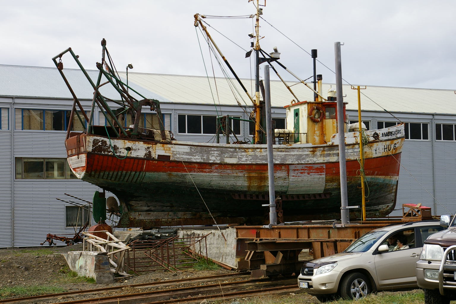
Skagaströnd
Abandoned boat / yfirgefinn bátur.
Skagaströnd
Spákonufell with horses in winter.
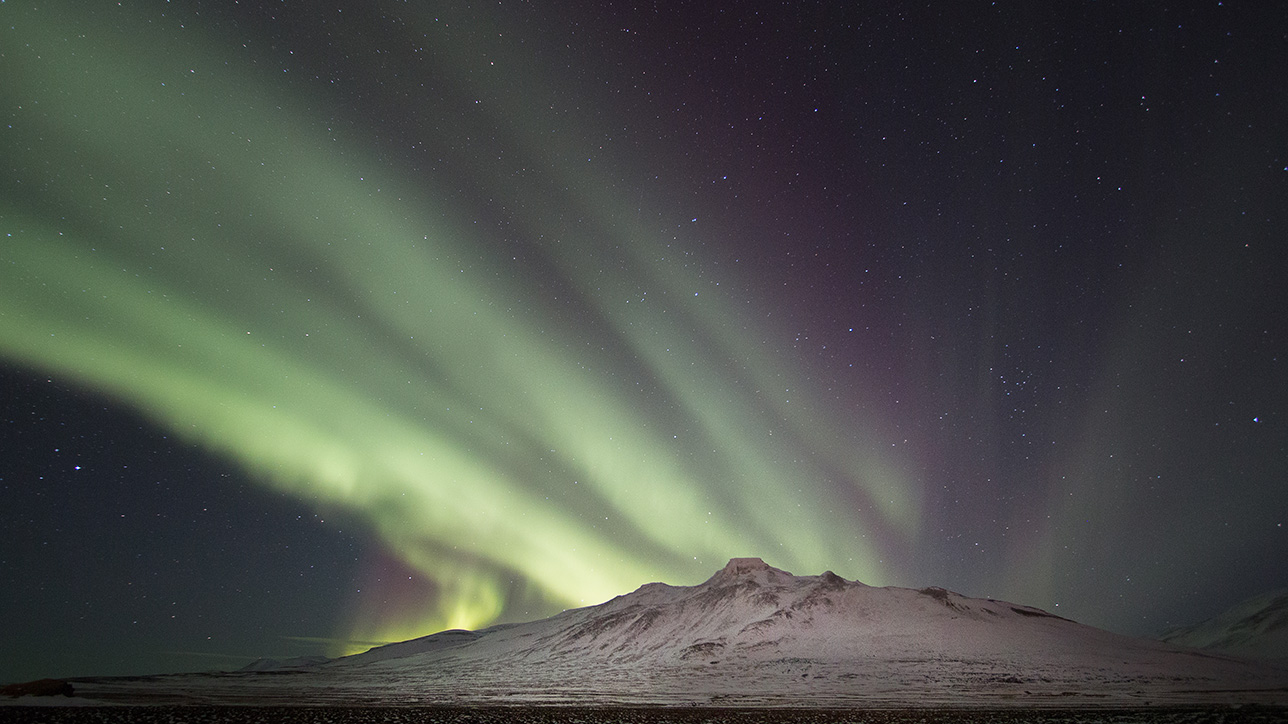
Arctic Lights
Arctic lights over Spákonufell.
Skagaströnd
Skagaströnd shore / ströndin við Skagaströnd.

Skagaströnd
Keta cliffs, Drangey island in Skagafjordur in the back / Ketubjörg, Drangey á Skagafirði í baksýn.

Skagaströnd
Fulmar having a filed time / múkki í makindum.
Kálfshamarsvík
Kálfshamarsvík and lighthouse / Kálfshamarsvík og vitinn.
Kálfshamarsvík
Columnar basalt in Kálfshamarsvík / Stuðlaberg við Kálfshamarsvík.
Kálfshamarsvík
Columnar basalt in Kálfshamarsvík / Stuðlaberg við Kálfshamarsvík.
Kálfshamarsvík
Columnar basalt in Kálfshamarsvík / Stuðlaberg við Kálfshamarsvík.
Kálfshamarsvík
Columnar basalt in Kálfshamarsvík / Stuðlaberg við Kálfshamarsvík.
Kálfshamarsvík
Columnar basalt in Kálfshamarsvík / Stuðlaberg við Kálfshamarsvík.
Kálfshamarsvík
Columnar basalt in Kálfshamarsvík / stuðlaberg við Kálfshamarsvík.
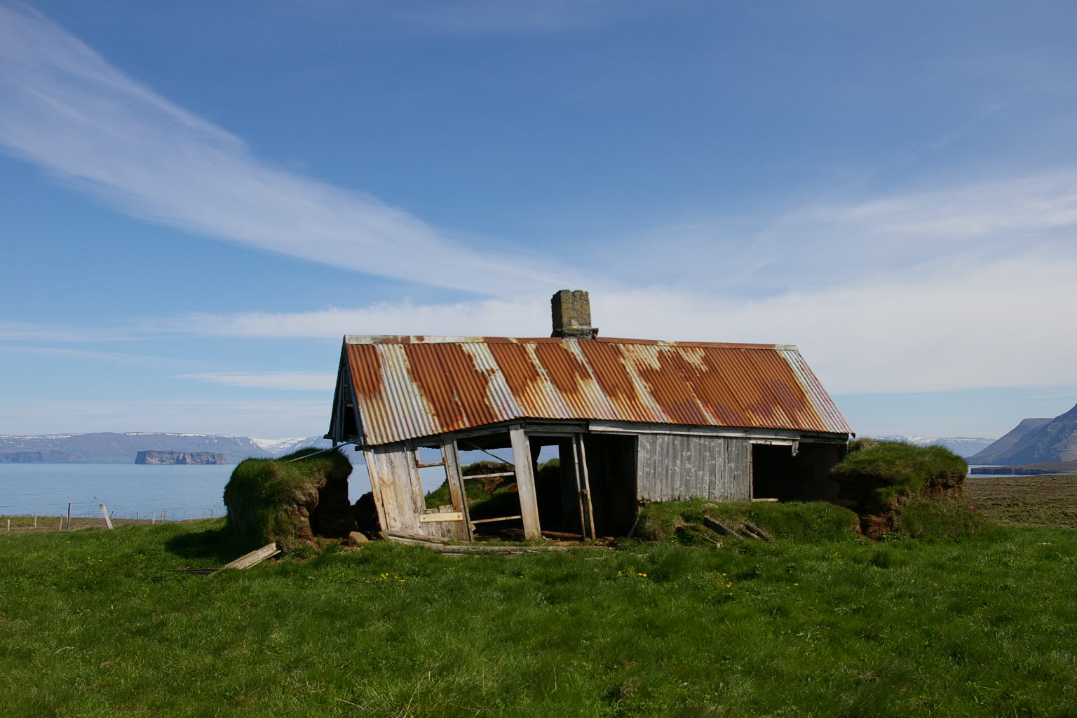
Skaginn
Skaginn, abandoned house / yfirgefið hús á Skaga.

Skaginn
Skaginn.
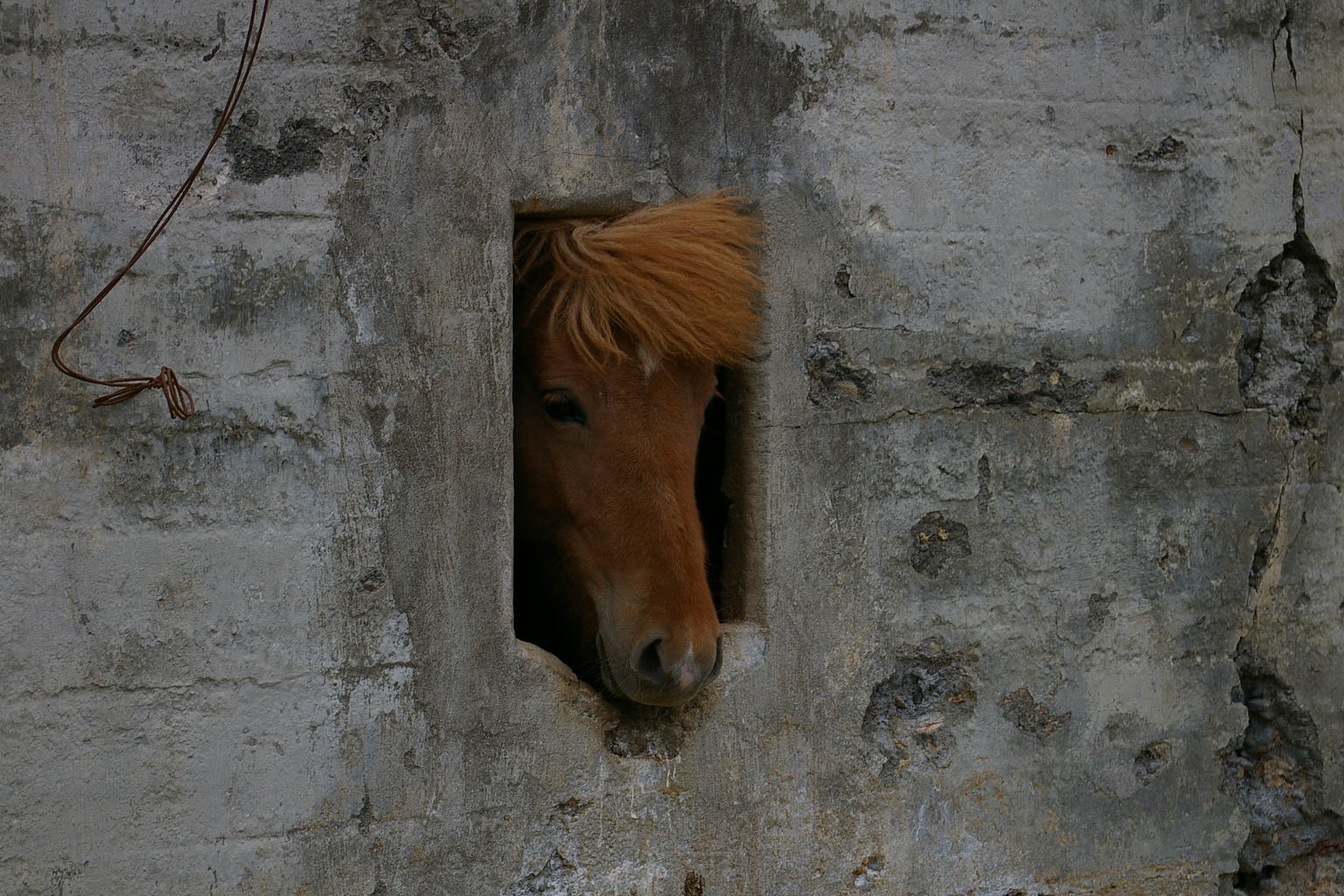
Skaginn
A curious horse / forvitinn hestur.
Skaginn
Keta cliffs / Ketubjörg.

nes-artist-residency-mynd-480×300
Book your room
Follow us!
![]()
![]()
![]()
Address
Einbúastígur 3
545 Skagaströnd
Iceland
GPS Coordinates:
Longitude -20.322100
Latitude 65.826200
Contact Us
Phone: +354 848 6051
Email: salthus@salthus.is